So much for “just digging a bit” – The collection of soil samples from a restored grassland site
1st logbook entry in the series "How does scientific fieldwork actually work?"
With spring also comes the start of the fieldwork season for us at Grassworks. More specifically, this means that the analyses of soil, vegetation, butterflies and wild bees on our grassland study sites are upcoming. These sites are 40 already restored grasslands per model region, as well as 10 positive and 10 negative reference sites, which we first had to find. The respective meadows and pastures had to meet certain criteria defined by us, and for all sites, we had to obtain the corresponding permits, e.g. for access and sampling, prior to the fieldwork. The positive reference sites are old, species-rich grasslands, while the negative references represent degraded grasslands. The findings obtained from the fieldwork are to be used for a retrospective ecological, as well as socio-ecological and socio-economic investigation of the restored grassland sites and thereby contribute to identifying factors that lead to the successful restoration of species-rich and thus also multifunctional grasslands in Germany. But what do such analyses look like in practice? What is being done on these meadows and pastures? And how can such conclusions be drawn from it?
This series of blog posts is intended to address these very questions and give an insight into our work by looking at one of our study sites as an example. We start with our first fieldwork logbook entry in March when our work in the field began with the collection of soil samples.
Logbook entry: Soil sampling of a study site
March 28, 2023
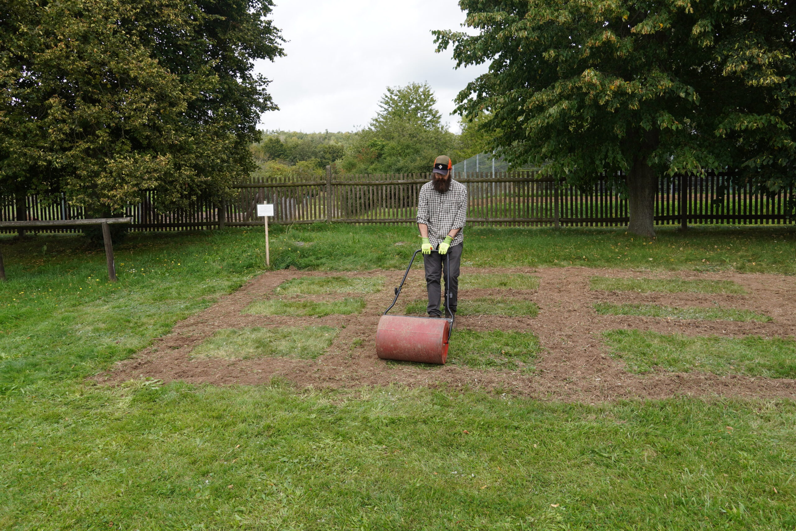
The grassland with the site code N_DWQ sampled today is a restored site in Schleswig-Holstein that was formerly arable land. In 2018, regional seed and threshing material from a donor site were sown here, so that many typical grassland plant species have already been able to establish themselves on the site. Today, the grassland is grazed by cows until April, while it is not grazed in the summer so that flora and fauna can flourish undisturbed during this time. Simultaneously, the site is used for seed production by mowing and subsequent threshing of the mown material.
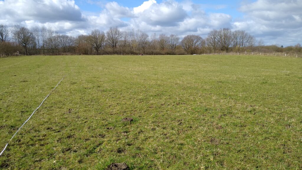
Figure 1: Photo of the grassland site N_DWQ described here in March (Photo: Juno Laschke).
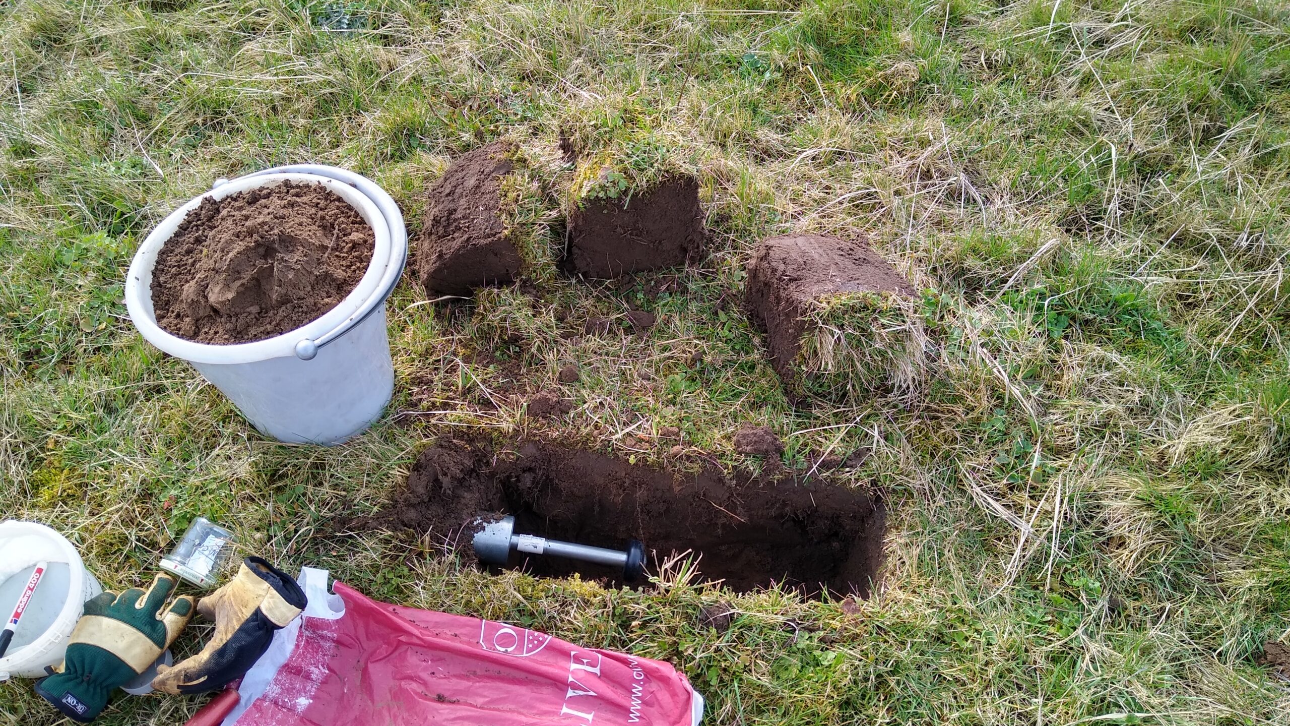
The purpose of soil sampling is to determine various soil parameters that provide information about the condition of the soil. For example, the carbon storage capacity of the soil can be determined, which is an increasingly important function in times of climate change. To make the sampling and thus its subsequent results comparable between the study sites, the samples must be taken systematically, always following the same pattern. For this purpose, we measured a 200 m long transect on each site, which we divided into four 50 m long sub-transects (Fig. 3), by GPS and marked them with sticks. On this site, a continuous 200 m transect would have been too long, therefore we divided it into two 100 m transects. Within each of the 50 m sub-transects, we randomly determined and marked a point that serves as a vegetation point. This vegetation point now marks the vegetation plot: a 4 m2 area that will later be used for vegetation recording, but also now for our sampling. Because this is where the actual collection of soil samples begins: per vegetation plot, we took soil samples with a drill stick (Fig. 2) at each of the four corners and additionally twice randomly along the edge so that we get six samples per vegetation plot (Fig.3).

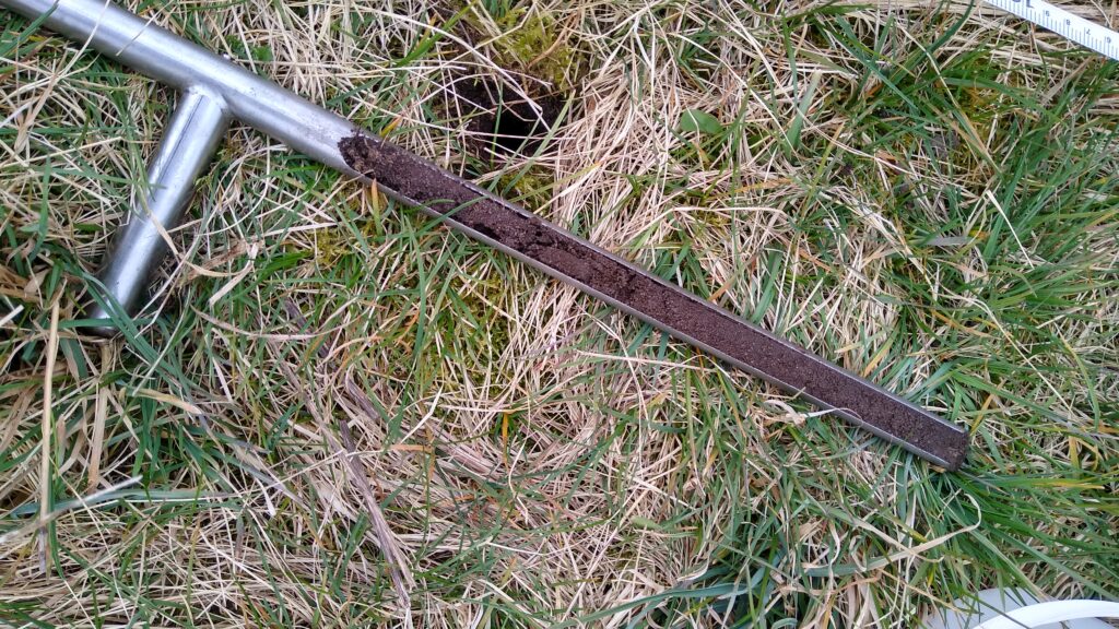
Figure 2: Drill stick during soil sampling (left) and after sampling with soil sample (right) (Photo: Juno Laschke).
These soil samples reached a depth of 30 cm and were divided into a topsoil layer of 0-10 cm and a layer of 10-30 cm. We collected all soil samples of a plot according to the soil depths in two buckets as a mixed sample and put them in bags. We repeated this procedure for the other three vegetation plots of the transect so that in the end we had a total of four bags of soil samples for the upper soil layer and four bags for the lower soil layer (Fig. 3). The collection of the soil samples as composite samples, as well as the multiple sampling distributed over the site, is intended to help ensure that the analysed soil samples represent the average soil values of the site, rather than representing single random soil values from a specific location in the soil. For this reason, the four soil samples of the same soil depth were also mixed afterwards in each case and one spoon of soil per bag was taken from these mixtures and mixed in another bag according to the soil depths. This allowed us to send one bag of the upper and one of the lower soil layer per site to the laboratory for analysis (Fig. 3). The rest of the samples are stored for potential later analyses. For example, since we took soil samples for all four vegetation plots, the gradient of the soil values on the grassland study sites could be shown.
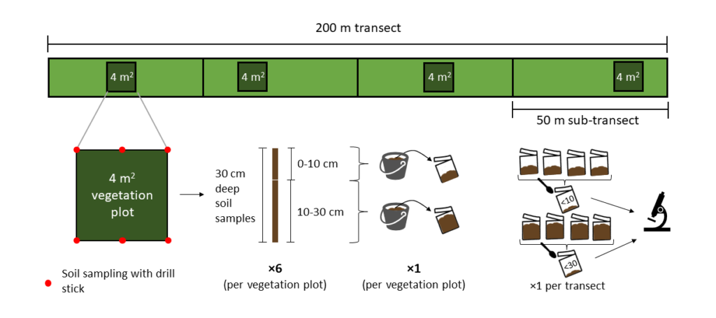
Figure 3: Overview of the structure of the transect and the steps of taking the soil samples (Diagram: Lea Pöllmann).
What do these soil samples tell us now?
But back to the samples that are now to be evaluated: The samples sent in are analysed in the laboratory for various parameters. These include soil texture, pH value, nitrogen content, and also carbon content (both inorganic and organic carbon). That way, we ultimately obtain one value per site for each parameter and soil depth. The upper soil layer of 0-10 cm is additionally examined for its microbial biomass, i.e. the microorganisms in the topsoil, so that it is possible to make conclusions about the biomass of microbial carbon and microbial nitrogen. This is relevant because microorganisms such as bacteria and fungi play a very important role in the soil and thereby ensure its functionality. For instance, they are significantly involved in the decomposition of organic material such as leaves or dead wood, and some of them, such as rhizobia bacteria or mycorrhizal fungi, live in symbiosis with plants enabling them to get a better supply of nutrients.
In order to derive conclusions about the carbon storage capacity as well as the total nitrogen content of the examined site, the parameters determined in the laboratory must be offset against the soil density, for which the volume of the soil needs to be determined. This can also be understood with a little imagination as follows: a compact, loamy soil differs in its density (and thus also in its mass for the same volume) from a loose soil consisting of a lot of organic material. Or to put it another way: a heavy marsh soil has different properties than the sandy soils of the Lüneburg Heath. It is exactly this density of the soil that we are investigating with cylindrical probes. The cylinders have a precisely defined volume and therefore serve to measure the mass and thus also the density of the soil on our grassland site. For this purpose, we dug a hole 60 cm long, 20 cm wide, and 30 cm deep as close as possible to two of the four vegetation plots, and for each of our soil depths (0-10 cm and 10-30 cm) we knocked a cylinder sideways into the soil (Fig. 4). The soil contained in the cylinder was then dried at 105 °C for 48 hours, sieved 2 mm fine and weighed. With the help of these values, the laboratory results are extrapolated to the total area and in this way, the total carbon and nitrogen contained in the grassland site are calculated.

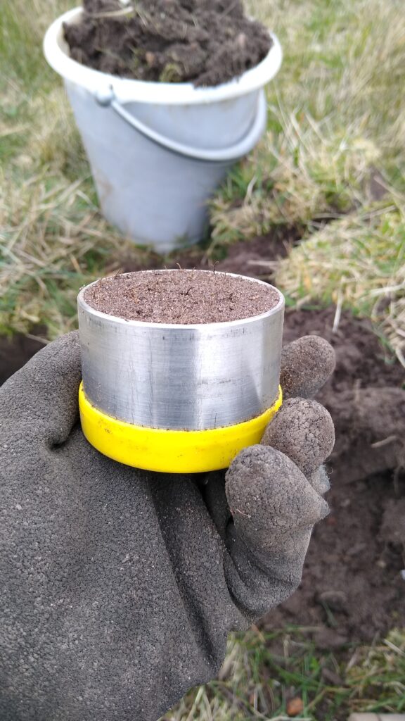
Figure 4: Sampling of a precisely defined volume of soil using a cylinder that is driven into the soil from the side (left) and the soil sample taken in the cylinder (right) (Photos: Juno Laschke).
What did the laboratory analysis show? – Results of the soil samples
The investigated grassland site has a loamy, slightly acidic soil, which belongs to the soil type group of clay loams (Table 1). The exact results of the soil samples in terms of inorganic (TIC) and organic (TOC) carbon, as well as total nitrogen (Nt) and total carbon (Ct) content of the site, can be taken from the table below in mass percent. With the help of these values, we can examine the differences in the soil between the study sites. This will allow us to determine, for example, which restoration measure can potentially have a positive effect on the carbon storage capacity of the grassland soils. These findings, in turn, will then feed into the analysis of the overarching question of the Grassworks project, which measures lead to success in grassland restoration.
Table 1: Laboratory values of the soil samples of the grassland site N_DWQ investigated here.
| Soil sample | pH | TIC | Ct | TOC | Nt | Soil type |
| M.-% | M.-% | M.-% | M.-% | |||
| N_DWQ_0-10 | 4.97 | 0.03 | 1.35 | 1.32 | 0.037 | Lehm Lts |
| N_DWQ_0-30 | 4.89 | 0.02 | 0.92 | 0.90 | 0.015 | Lehm Lts |
However, this is by far not all the information that is included in the ecological analysis. We will continue with the study of wild bees and butterflies as well as the vegetation on the grassland sites. So, there is still a lot of work ahead of us, of which you will soon be able to read more as part of this blog post series.

Lea Pöllmann
I am studying environmental and sustainability sciences with a focus on ecology and nature conservation at the Leuphana University of Lüneburg. I am particularly interested in ecosystem functions and interactions and how we can connect them with our social systems in a sustainable and mutually beneficial way. At Grassworks, I mainly work in outreach and am writing my thesis in the ecological research component.
Alina Twerski
I studied biology (B.Sc. and M.Sc.) with a focus on ecology and biodiversity at the University of Hamburg. During my PhD at the Technical University of Munich, I investigated the relationships and trade-offs between different ecosystem functions of rare arable plants and sown wildflower mixtures. As I mainly work on vegetation science, restoration ecology and ecosystem functions, my post-doc in the Grassworks project consists of organizing and conducting ecological fieldwork in the northern region (WP1). Further, my position is coordinating the ecological data collection of WP1 across all three regions. In addition, I am helping to restore grasslands in the Real-World lab in the northern region.
Leave a Reply