Ecological Research
The ecological research component aims to analyse the ecological success of various restoration measures in Germany. In each of the three model regions, 40 restored grassland sites will be compared with 10 non-degraded ‘positive reference sites’ in good ecological condition and 10 degraded ‘negative reference sites’ to analyse differences in biodiversity and their ecological functions and services.
Model Region North
Iserlowland, Southern heathModel Region Centre
Biosphere Reserve Karts landscape, Southern HarzModel Region South
Donau-Isar lowland, Lower BavariaResearch components in each model region
Restored sites
Positive reference sites
Negative reference sites
The restored sites in each model region have been selected to provide a wide range of initial conditions, for example in terms of age of grassland (time since restoration), methods of species transfer and grassland types. This should allow transferability of results. In addition, a gradient of restoration success should be mapped across the sites to learn from both successes and failures.
In order to enable the most comprehensive comparison of biodiversity, ecosystem functions (ESF) and ecosystem services (ESS) between the sites, several parameters were analysed on a total of 180 sites on 200 m × 5 m transects: Vegetation, wild bees & butterflies, soil, and landscape connectivity. The sites were divided over a period of two years (2022 and 2023). The relevant parameters and their analysis are described in more detail in the following:
Vegetation
For the vegetation study, both the species composition and structural parameters were analysed on 4 m² plots per 50 m transect section, and a total species list including frequencies was compiled for the entire 1000 m² transect.
Wild Bees and Butterflies
The recording of wild bees and butterflies is intended to illustrate the success of restoration at higher trophic levels and the associated ecosystem functions and services (such as pollination). They are also good indicators of land-use change, as they respond quickly and sensitively to changes in their habitats. Wild bees and butterflies were recorded by netting the four 50 m sections of each transect. Wild bees were netted in the centre of these transect sections over a width of 2 m, while butterflies were recorded over the full width of the 5 m wide transect. This survey was carried out for both butterflies and wild bees 4 times per site between May and August (i.e. once a month).
Soil
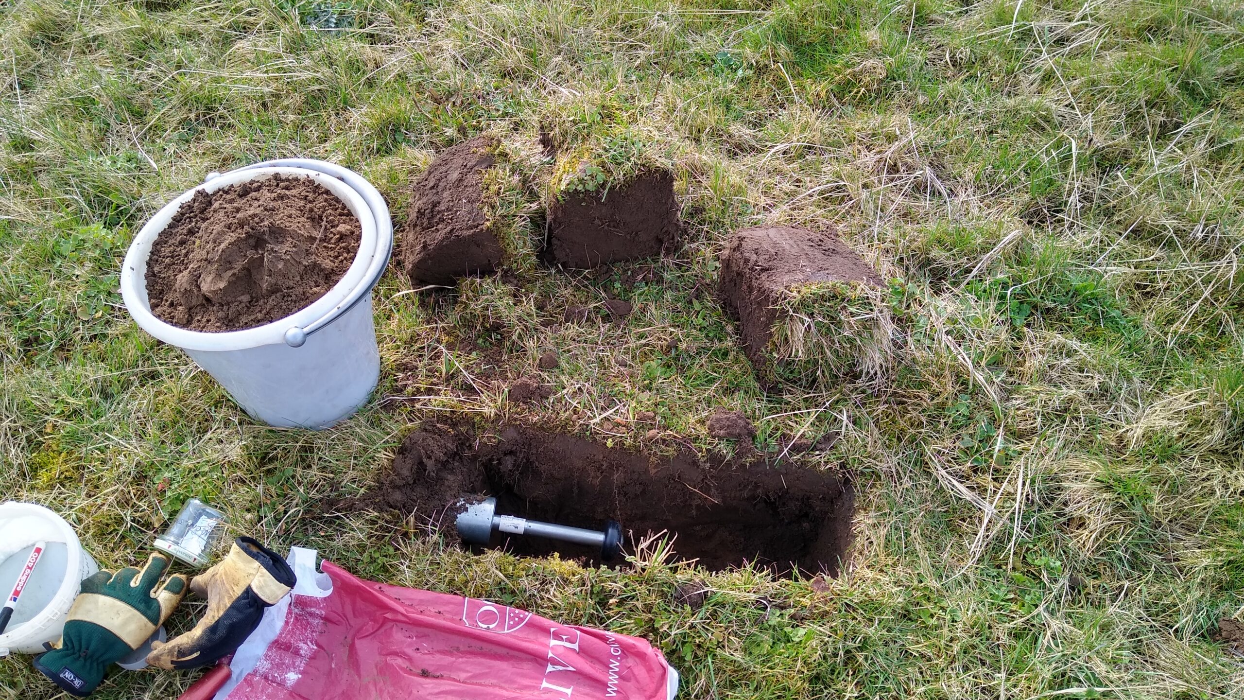
Soil samples were taken from two soil depths (0-10 cm and 10-30 cm) to analyse the soil for its soil nutrients (C:N:P ratio), soil organic carbon (SOC), and soil density. The microbial biomass of the topsoil samples was also determined. These values can be used to determine the carbon storage of the topsoil, as well as the biotic functionality and possible nutrient limitations of the microbes, which may influence the success of restoration. More information on soil sampling can be found here.
Landscape connectivity
Landscape connectivity is determined with the help of Geographic Information Systems (GIS) using aerial images and land use data (InVeKoS).
The data collected in the field is supplemented with existing data from stakeholders and converted into biodiversity indices. In addition, functional traits and functional diversity at the community level will be quantified using different approaches and existing trait databases, which in turn will serve as indicators of ecosystem functions (ESF) and ecosystem services (ESS). The ecological restoration success determined in this way will then be incorporated into the overall analysis, together with socio-ecological, socio-economic and policy data.